Masters in Geomatics Engineering

School of Business & Economics

Academic Freedom to Discover Your Purpose

Open Curriculum Design at Atlantic International University

At Atlantic International University (AIU), we believe that our masters in geomatics engineering degree captures the spirit of higher education in a decentralized learning environment emphasizing academic freedom. Geomatics, which combines surveying, geographic information systems (GIS), and spatial data analysis of information, is the right academic program for AIU’s unique learning outcomes. AIU believes in empowering people worldwide through individualized and self-paced learning, and your education should be transformative in someone’s life – a chance to study and explore future possibilities.

We offer a unique learning environment where you can study or research while travelling anywhere in the world, combined with our highest level of academic rigor. Students of geomatics engineering degree approaching a new phase of their education should not hesitate to explore the fast-paced and advanced areas of geospatial technology and engineering & spatial analysis, guided by Msc in Geomatics Engineering researchers from leading universities and previous experience, prepared with comprehensive virtual resources provided online.

Core Courses & Topics: Masters in Geomatics Engineering

Important: Below is an example of the topics or areas you may develop and work on during your studies. By no means is it a complete or required list, as AIU programs do not follow a standardized curriculum. It is meant solely as a reference point and example. Want to learn more about the curriculum design at AIU?

Check here: Course and Curriculum

The Master of Geomatics Engineering at AIU offers an extensive list of core courses and topics to develop both theoretical knowledge and applied skills. Students will be introduced to core topics such as: Geodesy, Remote sensing, GPS and GNSS Applications and Geographic Information System (GIS). Other subjects offered will include advanced Spatial Data Analysis, Cartographic Design, Surveying and Maps, Photogrammetry, Digital Terrain Models and Geospatial Data Management. The program also covers aspects of data science, programming for geospatial knowledge, and environmental monitoring. The courses enable students to develop skills and knowledge to solve real issues relating to Transport and Infrastructure, Natural Resources Management, Urban planning, among others.

Orientation Courses

At AIU, the orientation courses for the Master’s in Geomatics Engineering have been specifically developed to set students up for academic and professional success. AIU courses will introduce learners to the underlying philosophy of www.aiu.edu as it pertains to academic freedom and self-directed learning and purpose-driven education. The key orientation modules that comprise the orientation course work include: Principles of Andragogy and Omniology, Learning the AIU Way, Academic and Career Development, Information Literacy and Online Research Skills, Ethics and Professional Responsibility, and Time Management for Distance Learners. These modules provide students with vital orientation to support them as they navigate the AIU platform, and critically engage the focus, mentality and approach needed for independent, meaningful study in an emerging discipline.

  • Communication & Investigation (Comprehensive Resume)
  • Seminar Administrative Development (Book Summary)
  • Organization Theory (Portfolio)
  • Seminar Cultural Development (Practical Experience)
  • Experiential Learning (Autobiography)
  • Seminar International Development (Publications)

Research Projects

Research in online masters in geomatics engineering plays an integral role in the Master’s in Geomatics Engineering at AIU, giving students the skills and expertise to leverage the application of spatial technologies as innovative responses to worldwide challenges. Students engage in purposeful, interdisciplinary projects that further the interests of the students and assist them in achieving both undergraduate and professional goals. 

Some examples of postgraduate geomatics programs with research topic areas in geomatics engineering include; Urban Growth and Land Use Change Mapping; Crisis Management Using GIS and Remote Sensing; Climate Change Assessment; Smart City Infrastructure; Geospatial Solutions to Agriculture and Water Resource Management; and 3D Modelling for Heritage Preservation. Through the research projects of geomatics engineering career, students produce relevant, data-driven products which contribute to the technological and sustainable growth of society and the world.

  • MBM300 Thesis Proposal
  • MBM302 Masters Thesis (5,000 words)

Are You Ready to Apply for Masters in Geomatics Engineering?

Click Here

Thesis Defense: Masters in Architecture

The thesis defense being held for the Master’s program in Geomatics Engineering at AIU signifies the student’s completion of their academic program, and ultimately represents their learning and abilities in advanced geospatial concepts and independent research. AIU is committed to academic integrity and to producing innovative change agents committed to improving their communities in the real world. Therefore students have free rein to pursue original, real world topics for their own research projects, so long as they align with their interests and aspirations.

 During the defense, candidates share the research for advanced geom, knowledge and professionalism with their peers, faculty, and practicing geometricians. They have defended advanced geomatics studies submissions with critical thinking, research approaches, and appropriate uses of naturalism via geomatics technologies. The topic of the master of science (MS) in geomatics thesis is also significant as it acknowledges their research context and a contemporary practice to prepare them for current standards of geo-spatial leaders who are equipped to navigate their future work environment that is driven by quantitative data.

Masters in Geomatics Engineering Student Experience

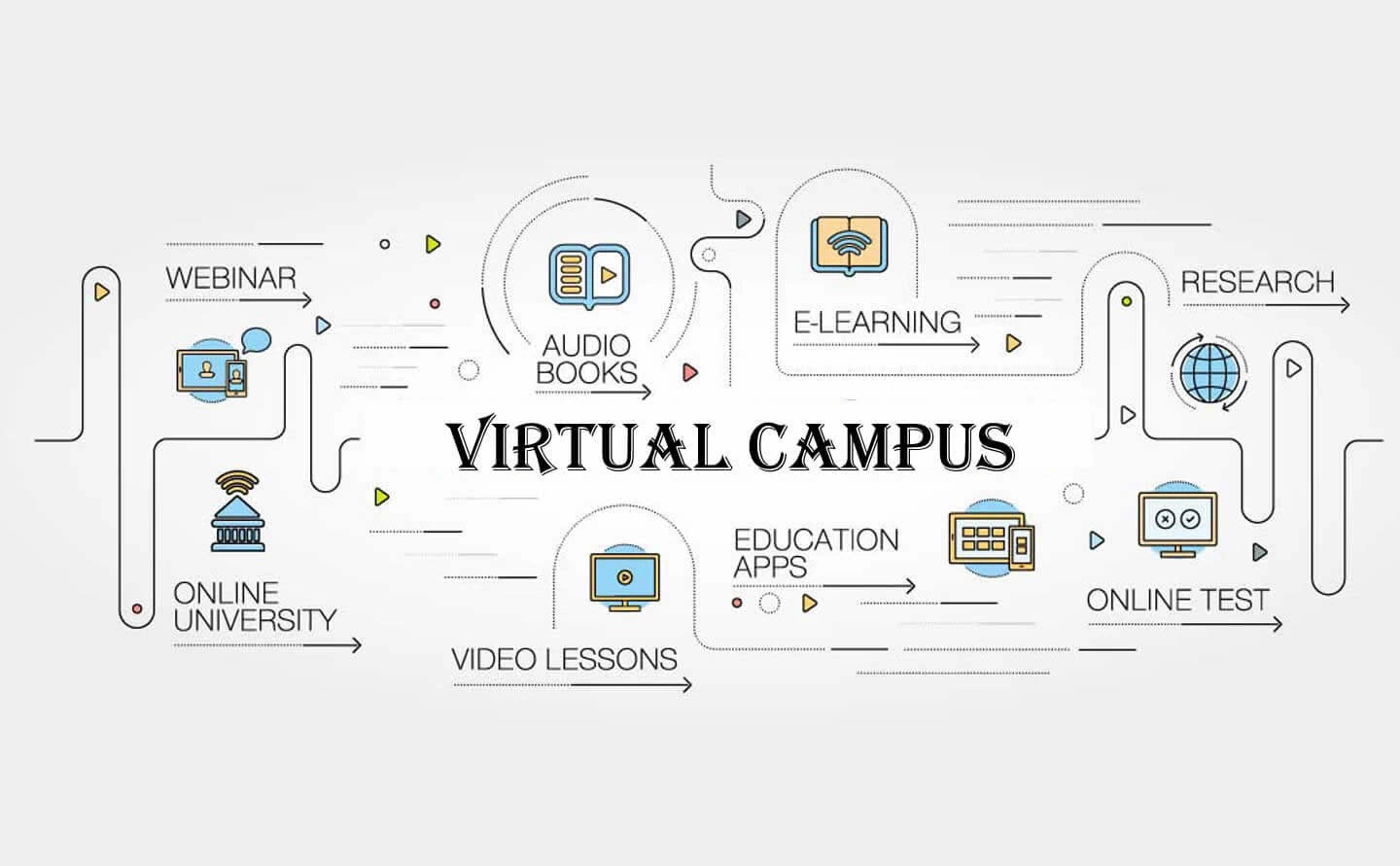
The student experience in the Master’s in Geomatics Engineering program at AIU is a personalized and AI-driven educational experience that caters to an individual learner’s goals. It includes pace; Each learner has a different pace of learning. With the AIU framework built upon it’s advanced virtual campus and intelligent tools, students will be provided personalized coaching, on-demand academic support, curated resources, and knowledge development to assist with the overall understanding of complex geospatial technologies, during their learning journey.

Each learner has access to dynamic and engaging platforms, on-demand feedback and knowledge, engaging dynamic learning components to keep them engaged with learnt content, and behaviours and progress. Given the flexibility of AIU’s program, the student has access to a global academic community for Geographic Information Systems (GIS) that is empowering and transformative in that students can innovate, lead, and apply geomatics solutions to real-world problems – anytime and anywhere.

Community & Social

At AIU the Master’s in Geomatics Engineering inextricably links global responsibility and community engagement into the academic and professional landscape. The AIU academic community, with its remarkable diversity and international scope, considers cooperation, cultural exchange, and common vision to be fundamental to the whole learning journey. Collectively, the wider AIU geospatial research, from student-led initiatives to field work, gives students the opportunity to critically reflect on how they can contribute to socially responsible and urgent solutions to societal and environmental challenges, which include, but are not limited to, climate mitigation, disaster preparedness, urban revitalization, and fair allocation of resources.

Through the experience of joining in sustainable development initiatives, mapping communities unjustly excluded from geomatics-derived services, using AIU’s learning platforms, or participating in humanitarian initiatives at AIU, students will learn the capacity of geomatics to catalyze social change—reconciling their formal learning with movements for global change.

Contact Us Today!

Begin Your Journey!
AIU’s Summer of Innovation and Growth gives you the ability to earn up to $5000 in tuition credit by completing free lessons and courses.
Whether you’re looking to acquire new skills, advance your career, or simply explore new interests, AIU is your gateway to a world of opportunities. With free access to 3400 lessons and hundreds of courses the ability to earn credits and earn certificates there’s no better time to start learning.
Join us today as a Guest Student and take the first step towards a brighter, more empowered future.
Explore. Learn. Achieve.

Academic Resources

Students enrolled in AIU’s Master in Geomatics Engineering program have access to a gigantic selection of academic resources to facilitate independent inquiry, research, and development. This program includes 24/7 access to AIU’s advanced Virtual Campus which consists of over 260,000 books, 3824 minicourses, 750 live classes, 434 webinars, 160 virtual laboratories, and more than 2500 additional creative assignments and subject matter. In addition, specialized featured tools, such as artificially intelligent course builders, geospatial simulation environments, pre-recorded interactive content, and hosted interactive content, enable and help students refine their skills in fields such as land surveying, GIS systems, remote sensing, mapping technology, spatial data parsing and many others. The available resources guarantee every learner continues to have options to manage their personal learning journey which embraces all technology development within the geomatics engineering discipline.

Live Classes

Students in the Master’s program in Geomatics Engineering at AIU can take advantage of two live classes offered each day. Each live class is very unique and dynamic. Students take the same class each time, but there are many different topics available, from the basics of GIS to advanced applications of GIS, remote sensing, and spatial analysis. Each session of a class is presented by a respected faculty member or industry practitioner. Live classes allow for classmates to gather together and talk about pertinent topics, such as opportunities to discuss, collaborate, and problem-solve directly with a specialized facilitator on a specific topic, get feedback in real-time, and learn as a community of scholars and practitioners.

The daily live classes are accessible for students and instructors anywhere in the world so this ensures attention, news and connection to the discipline of geomatics engineering on a daily and sometimes, a multiple daily basis.

AIU Live Classes Examples on Geomatics Engineering :

Special Projects, Research Publications, & Co-Authoring

The Master’s program in Geomatics Engineering at AIU allows students to participate in special projects, write original research, and co-author with their professors. This can be done in a flexible supportive academic environment. Whether participants develop new geospatial technologies, participate in environmental mapping programs, or engage in urban data modeling, the research can be purposeful and focus on issues relevant to today’s world.

AIU participates in an academic community formed through a global platform. AIU students have access to the AI-powered tools and the global academic community. AIU has opportunities for publishing in academic journals and co-authoring with professors – we designed this with the idea to increase visibility and credibility while a student completes a master’s in geomatics engineering. Ultimately, we’ve created a program to build expertise and recognition in the field of geomatics.

Get Free Access to AIU Resources

Begin Today

Career Center for Masters in Geomatics Engineering

The Master’s in Geomatics Engineering at AIU includes a Career Center offer to provide support and help students prepare with services that fit their needs as they set out into employment. Whether the graduate’s next step is in GIS (Geographic Information Systems), Remote Sensing, Urban Planning, or Environmental Management, they will be given the tools required to succeed, such as counseling, placements, and connecting to major influencers in their markets.

The workshops we offer, where students practice resume building and have exclusive access to advertised positions, lend significant contributions to students during the transition from studying to being employed. We are serious about supporting our students so that they have the potential to create measurable impacts on their respective markets around the world in the geomatics industry.

Job Description

Students graduating from the Master’s in Geomatics Engineering program acquire competencies in spatial data collection, analysis, and management, which makes them incredibly valuable employees in spatial data areas like infrastructure design and development, environmental monitoring, urban planning, and geospatial intelligence. The interdisciplinary and theoretical/practical curriculum help students understand spatial data concerns, while also providing them with the knowledge to apply analytical thought processes with advanced technology in unique ways to create solutions to complicated spatial problems. Following the substantial training and education received at AIU, graduates enter the profession with not only the same job-ready competencies as other graduates, but with the ability to lead the arena of moving two-dimensional perceptions of GIS and mapping into interactive three-dimensional representations across geomatics disciplines.

Examples of potential job titles could include: 

  • Geomatics Engineer
  • Geographic Information Systems (GIS) Analyst
  • Remote Sensing Specialist
  • Surveying and Mapping Engineer
  • Cartographer
  • Geospatial Data Scientist
  • Urban Planning Consultant
  • Environmental Consultant
  • Land Information Manager
  • Navigation Systems Engineer
  • Spatial Data Infrastructure (SDI) Specialist
  • Geospatial Intelligence Analyst
  • Infrastructure Planning Specialist
  • Hydrological Modeling Specialist
  • 3D Mapping and Visualizing Specialist

Tools for Masters in Geomatics Engineering

The Master’s in Geomatics Engineering program at AIU provides students with hands-on experience using the industry-standard tools for advanced spatial data processing, modeling, and analysis. Far more than just using tools and software with coursework, research, or projects, students are making use of the latest, top-notch technologies and professionally using them as they gain valuable technical expertise working with these today. By mastering these technologies, graduates become highly qualified job seekers in surveying, urban planning, environmental management, or geospatial intelligence industries.

Associations for Masters in Geomatics Engineering Professionals

Professional associations are a key part of developing students and professionals in Geomatics Engineering and providing networking. Accordingly, the American Intercontinental University (AIU) recommends Master’s students to engage with professional organizations to stay informed about industry standards, attend conferences, collaborate on research, access certification options, and more. Membership in those valuable associations enhances a graduate’s professional profile and promotes the possibility of collaborating and working around the globe, as well as promoting student and professional, lifelong-learning in the geospatial sciences.

Explore AIU’s Virtual Campus Now

Get Started

Masters in Geomatics Engineering Requirements

The Master’s in Geomatics Engineering program at AIU is open to anyone who possesses the qualifications to demonstrate they are academically prepared and has a desire to improve their knowledge and skills in the field of spatial sciences and geospatial technologies. Most applicants to the program have a degree in Geomatics, Civil Engineering, Geography, Environmental Science or related fields. In addition to their academic transcript, applicants shall provide a Statement of Purpose that explains their professional possibilities, a résumé or CV summarizing their relevant experience, and any other supporting materials, for example, letters of reference or certifications. The open, inclusive, and flexible admission thinking of AIU allows the opportunity to assess professional experience and prior learning for entry as part of the admission process and affords access to qualified applicants with diverse experiences.

How Can You Apply?

  1. Check the Program Requirements
    –  Visit AIU’s official admissions page to assess eligibility (degree in Geomatics, Engineering, or other related area); confirmation of required level English in need of prerequisites completion.
  2. Prepare your Application Material
    – Academic transcripts of all previous schooling
    – Statement of Purpose (2 – 3 pages, goals, research interests, and a discussion of why AIU is a good fit for you as a student)
    – Résumé or CV discussing relevant technical skills with experience
    – 2 – 3 letters of recommendation (academic or professional)
    – Where applicable, English proficiency scores (IELTS, TOEFL, etc.)
    – Certifications (e.g., GIS, surveying), or other aspects such as a portfolio of academic proposals or projects
  3. Create an online application account
    – You will need to register on AIU’s admissions portal. Fill in your contact information, intended program, and then proceed to upload all the required application documents.
  4. Submit the Application Form and fee
    – Complete each section of the application form, making sure you cross-check every detail. You then upload your application documents and pay the non-refundable application fee. 
  5. Check on your application status
    – You will be able to check if the application was received, if there are any letters missing, and whether progress is made on your applications, in the portal dashboard.
  6. Interview or additional assessment (if required)
    – Some applicants may be invited and requested to submit a brief technical capability statement, or a sample of work as an invited virtual interview.
  7. Wait for an Admissions decision
    – You should generally receive an admissions decision within about 4 – 6 weeks following the interview or submission of any outstanding assessments. You will receive an official offer letter in your AIU application portal and also via email.
  8. Confirm Enrolment
    – Once you have received an offer to accept, you will need to choose to accept it by the response date provided by AIU and pay the deposit (if required). There could be other requirements (e.g. final transcripts) and additional documentation to submit.
  9. Prepare for enrolment
    – Now that your enrolment has been confirmed, it’s time to take care of things like preparing your student visa (if you are an international student), housing arrangements, and to get registered into your courses, etc. You’ll get next steps and an invitation to important orientation events from the AIU’s enrollment advisor.

Financial Support & Scholarships

AIU is committed to making its Master’s in Geomatics Engineering both affordable and accessible. Many forms of financial assistance are offered to qualified students: merit-based scholarships are based on academic achievement and leadership qualities; need-based grants assist with tuition and living expenses; graduate research and teaching assistantships provide stipends and supporting faculty associated spatial data projects; a list is published of additional funding sources, including professional society scholarships and awards provided by industry; and other forms of support will be developed as needed. With all these offerings, students are ensured additional and more manageable ways to achieve an advanced geospatial degree without significant personal financial burden.

How much does it cost per year to get a Master's Degree in International Marketing from AIU?

In its Master’s in International Marketing degree, AIU provides two defining features; affordability and accessibility. AIU’s approach to inclusive and flexible education is deeply rooted in the tuition structure and the fact that students can pay for tuition on a schedule that is financially amenable to them. With the option to pay for tuition in a number of monthly payments, or even just pay what they can, students are free from an upfront financial burden and can focus on their education. By allowing flexibility and affordability, AIU makes it possible for future marketing professionals throughout the world to pursue their education and future careers in a way that makes sense for their pursuit of education.

FAQs

What are the admission requirements for a geomatics engineering master’s program?

A bachelor’s degree, transcripts, statement of purpose, résumé/CV, and letters of recommendation or certification (optional).

What career opportunities are available after completing a master’s in geomatics engineering?

Career options include GIS analyst, remote sensing specialist, surveyor, geospatial data scientist, urban planner consultant, etc.

Is a geomatics engineering degree the same as a geospatial or GIS degree?

Not exactly, they do overlap but geomatics engineering is much more broad than GIS. Geomatics engineering includes surveying, remote sensing, and geospatial technologies, including GIS.

Can I pursue a master’s in geomatics engineering online?

Yes, AIU offers a master’s in geomatics engineering online.

Let us know your goals and aspirations so we can chart a path at AIU to achieve them!
//
Admissions Counselor
Sandra Garcia-Fierro
Available
//
Admissions Counselor
Rene Cordon
Available
//
Admissions Counselor
Juan Mejia
Available
//
Admissions Counselor
Ariadna Romero
Available
//
Admissions Counselor
Alba Ochoa
Available
//
Admissions Counselor
Veronica Amuz
Available

"*" indicates required fields

This field is for validation purposes and should be left unchanged.
Name*

"*" indicates required fields

This field is for validation purposes and should be left unchanged.
Name*

"*" indicates required fields

This field is for validation purposes and should be left unchanged.
Name*

"*" indicates required fields

This field is for validation purposes and should be left unchanged.
Name*

"*" indicates required fields

This field is for validation purposes and should be left unchanged.
Name*

"*" indicates required fields

This field is for validation purposes and should be left unchanged.
Name*

"*" indicates required fields

This field is for validation purposes and should be left unchanged.
Name*

"*" indicates required fields

This field is for validation purposes and should be left unchanged.
Name*

"*" indicates required fields

This field is for validation purposes and should be left unchanged.
Name*

"*" indicates required fields

This field is for validation purposes and should be left unchanged.
Name*

"*" indicates required fields

This field is for validation purposes and should be left unchanged.
Name*

"*" indicates required fields

This field is for validation purposes and should be left unchanged.
Name*

"*" indicates required fields

This field is for validation purposes and should be left unchanged.
Name*

"*" indicates required fields

This field is for validation purposes and should be left unchanged.
Name*

"*" indicates required fields

This field is for validation purposes and should be left unchanged.
Name*

"*" indicates required fields

This field is for validation purposes and should be left unchanged.
Name*

"*" indicates required fields

This field is for validation purposes and should be left unchanged.
Name*

"*" indicates required fields

This field is for validation purposes and should be left unchanged.
Name*

"*" indicates required fields

This field is for validation purposes and should be left unchanged.
Name*

"*" indicates required fields

This field is for validation purposes and should be left unchanged.
Name*

"*" indicates required fields

This field is for validation purposes and should be left unchanged.

Submit your data.

After submitting, a widget will appear at the bottom-left corner so you can start your training.

Name*

Do you hate spam? Don’t worry, we hate them too. Your email is 100% secure with us.

"*" indicates required fields

This field is for validation purposes and should be left unchanged.

Submit the form below to begin your interview.

After submitting, a widget will appear at the bottom-left corner so you to start your AI interview.

Name*
Accepted file types: docx, pdf, Max. file size: 500 MB.

Do you hate spam? Don’t worry, we hate them too. Your email is 100% secure with us.